

The Tōkaidō: a print at the next stop
Of the three roads in Journeys, the Tōkaidō is the one I think fits Kinoku best. I found it while researching the feature, and the art was a large part of the appeal. Your movement takes you through a set of places, with a real Hiroshige print waiting at each stop.
I wanted Journeys to offer a little curiosity alongside the sense of making progress. The Tōkaidō gives that idea something quite specific to work with: a road, a sequence of pictures, and people going about their lives inside them.
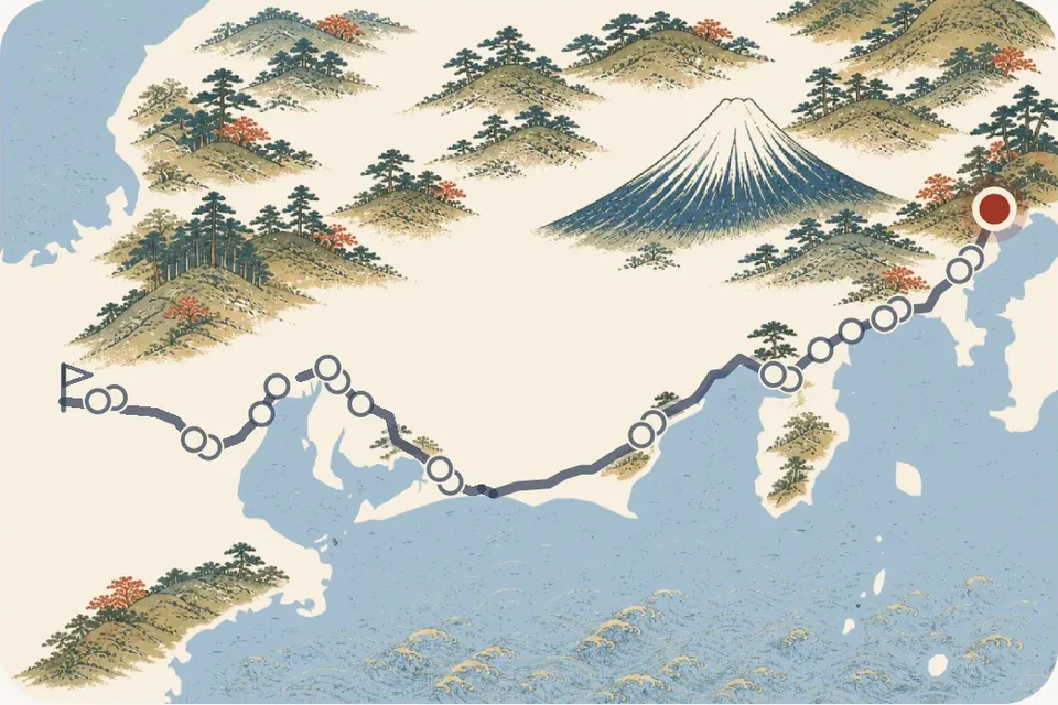
A road with 53 stations and 55 pictures
The Tōkaidō linked Edo, now Tokyo, with Kyoto. Its post stations gave travellers places to rest and helped move letters and goods along the road. Fujisawa's official history describes 53 stations along a route of about 492 km, from Nihonbashi to Sanjō Bridge.
Hiroshige's Fifty-three Stations of the Tōkaidō includes the two ends as well, giving the series 55 pictures. Kinoku follows that sequence, so Nihonbashi is the starting stop and Kyoto is the finish. The MOA Museum of Art's account of the Hōeidō edition describes the complete set and its publication around 1833.
A stop can hold much more than a landmark. At Shōno, people hurry through a downpour; at Kanbara, snow changes the whole feel of the scene. The museum points to those changes in weather and time of day as part of how Hiroshige shaped the road. The pictures give you different things to notice as you go.
The picture belongs to the place
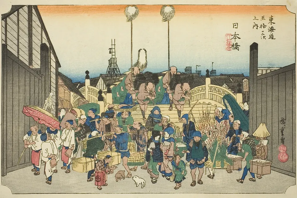
Nihonbashi is a useful place to start looking. A procession comes over the bridge, while people carrying goods fill the foreground. Kinoku uses a scan held by the Art Institute of Chicago, dated around 1833/34, from the Clarence Buckingham collection.
The Tōkaidō's pictures are museum scans of Hiroshige's work, released into the public domain. Each has an artist and museum credit in the app. The print shown here is the same image used at the starting stop, so you can compare the artwork with how it appears on a phone.
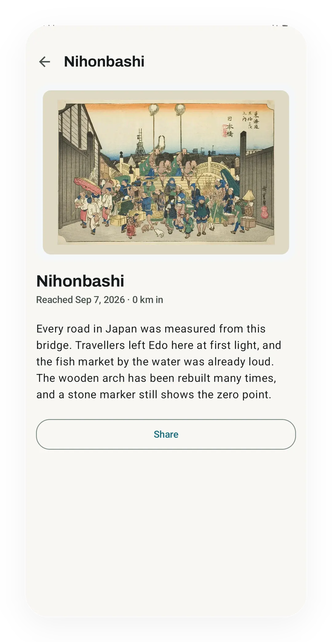
Most pictures wait until you reach their stops, though the picker lets you see a few before choosing the road. Once a picture opens, you can look at it more closely and read about its place. That is the part I hoped would make a familiar walk lead to something new, even on an otherwise ordinary day.
How the 492 km becomes stops
Kinoku uses 492 km for the whole road, matching the approximate length given by Fujisawa's history. Within that total, the app stores rounded distances from the start: Shinagawa at 8 km, Hakone at 98 km and Kyoto at 492 km. Those are Kinoku's progress marks, rather than a fresh survey of every stretch of the old highway.
The spacing is uneven because the road's places are unevenly spaced. Miya sits at 342 km and Kuwana at 369 km, leaving a 27 km gap. That stretch represents the historic sea crossing. Kuwana City's account explains its name, Shichiri-no-Watashi, as a crossing of seven ri, about 27 km.
You cover that section with the same movement as the rest of the Journey, even though the historic travellers took a boat. The map marks the water crossing with a dashed line. The drawn route is a way to follow the places, rather than directions for walking the full road today.
All 55 stops and their distances
These are Kinoku's rounded progress marks, not directions for walking the route today. Each number is a total from the start.
| Stop | From the start |
|---|---|
| Nihonbashi | 0 km |
| Shinagawa | 8 km |
| Kawasaki | 18 km |
| Kanagawa | 27 km |
| Hodogaya | 32 km |
| Totsuka | 41 km |
| Fujisawa | 49 km |
| Hiratsuka | 63 km |
| Ōiso | 66 km |
| Odawara | 81 km |
| Hakone | 98 km |
| Mishima | 112 km |
| Numazu | 118 km |
| Hara | 124 km |
| Yoshiwara | 136 km |
| Kanbara | 147 km |
| Yui | 151 km |
| Okitsu | 160 km |
| Ejiri | 164 km |
| Fuchū | 175 km |
| Mariko | 181 km |
| Okabe | 188 km |
| Fujieda | 195 km |
| Shimada | 204 km |
| Kanaya | 208 km |
| Nissaka | 215 km |
| Kakegawa | 222 km |
| Fukuroi | 232 km |
| Mitsuke | 238 km |
| Hamamatsu | 253 km |
| Maisaka | 264 km |
| Arai | 266 km |
| Shirasuka | 272 km |
| Futakawa | 278 km |
| Yoshida | 284 km |
| Goyu | 294 km |
| Akasaka | 296 km |
| Fujikawa | 304 km |
| Okazaki | 310 km |
| Chiryū | 325 km |
| Narumi | 336 km |
| Miya | 342 km |
| Kuwana | 369 km |
| Yokkaichi | 382 km |
| Ishiyakushi | 393 km |
| Shōno | 396 km |
| Kameyama | 404 km |
| Seki | 409 km |
| Sakanoshita | 415 km |
| Tsuchiyama | 425 km |
| Minakuchi | 436 km |
| Ishibe | 450 km |
| Kusatsu | 461 km |
| Ōtsu | 475 km |
| Kyoto (Sanjō Bridge) | 492 km |
From your steps to the next print
Shinagawa opens when your Journey reaches 8 km. A tracked 3 km walk can supply part of that distance, with later walks and eligible daily steps adding the rest. Steps recorded during tracked sessions are left out of the extra step credit, so the same walk does not count twice.
For daily steps, Kinoku 1.4 uses a base estimate of 0.762 metres per walking step. For example, 10,000 steps classed as walking add about 7.62 km when all of them qualify. That would leave about 380 metres to Shinagawa if you began at zero and had no other credit.
Brisk steps use a slightly longer estimate, and running steps longer again. This is an app estimate, not a measurement of your own stride. The full calculation and its limits explain why there is no single step total for finishing the road.
I hope reaching a print gives you a reason to pause and look, as well as a reason to keep going. The Journeys guide explains what counts and how to start. If you try the Tōkaidō, I'd like to hear which picture makes you stop for a closer look.
Related features
Try Kinoku
Core tracking works offline. No mandatory account. No Kinoku-hosted training-history cloud.
Get on Google Play →