

Journeys
Turn your walks, runs and steps into a trip along Hadrian's Wall, the Tōkaidō or the Odyssey. Reach a stop, uncover its picture.
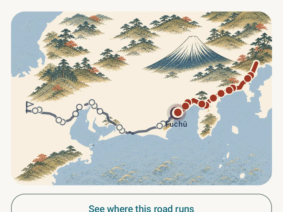
Your usual walk can take you somewhere new
Start a Journey in Kinoku and the walk to the shops, your run before work and the steps you fit into a busy day all move you along a road you have chosen.
At each stop, a picture opens and there is something to read about where you have arrived. You can look around, make a postcard to share, or carry on toward the next one, without a deadline hanging over the weekend.
New in Kinoku 1.4.0, Journeys works alongside your normal tracking, so the road needs no extra activity to be logged.
Which road will you walk?
| Road | Distance | What you will find |
|---|---|---|
| Hadrian’s Wall | 135 km · 11 stops | A coast-to-coast walk across northern England, from Wallsend to Bowness-on-Solway. The free Roman Fresco edition has its own illustrated map, with pictures of the wall, forts and surrounding country made for Kinoku. |
| The Tōkaidō | 492 km · 55 stops | The old coast road from Edo to Kyoto, seen through Hiroshige’s woodblock prints. Each stop tells you about the place and what he drew there. |
| The Odyssey | 2,400 km · 14 stops | A long trip from Troy to Ithaca, following the voyage through islands, storms and detours. The distance is chosen for the Journey, not a measurement of Odysseus’s sailing route. |
All three are free from the first stop to the finish. Hadrian’s Wall also comes in a Sandstone Relief edition for Pro, with carved-stone artwork over the same road, while its Roman Fresco edition stays free to walk.
The picker shows a few prints from each road before you start. Every stop’s name and distance are listed too. Most of the artwork stays covered until you reach it, so there is still something to discover after the first look.
What moves your marker
Tracked runs, tracked walks and daily steps can all count. Steps taken during a tracked session are excluded from the extra step credit, so the same walk does not move you twice as far.
Each source has a switch under What counts, and turning one off keeps its earlier distance while new activity from that source stops counting. A road begins on the day you start it, including that day’s qualifying activity. Older workouts stay in your training history without advancing a road you have just started.
Lifting can contribute if you want it to. Gym work starts off, and enabling it uses a stated rule: 2,000 kg of logged volume counts as 1 km. Lifted distance is shown separately from distance you covered on foot. It is an optional way to play, not a claim that lifting a weight is the same as walking a kilometre.
If your steps are not coming through, check the source first. The road can use steps from your phone, a watch or Health Connect; it cannot count movement that none of them recorded. Its page points you to the step tracker when phone counting is off.
How steps become distance
Journeys converts eligible daily steps into an estimated distance. In Kinoku 1.4, ordinary walking steps use 0.762 metres per step. Steps classed as brisk walking use that value multiplied by 1.05, and running steps use it multiplied by 1.20.
For example, 10,000 eligible steps classed as walking add about 7.62 km. The same count classed entirely as brisk walking adds about 8.00 km, while running steps add about 9.14 km. A real day can contain a mix of all three, so a road has no fixed number of steps to finish.
These are the app’s conversion assumptions, rather than a measurement of your own step length. Journeys currently uses the fixed base value even if you have entered your height. A tracked walk or run uses its recorded distance; steps during tracked sessions are excluded from the extra daily step credit.
The stories behind the roads
Each route article explains its places and distances, with sources beside the claims and a full list of the app’s stops.
- The Tōkaidō: a print at the next stop looks at Hiroshige’s work and the road behind its 55 pictures.
- Where was Odysseus, exactly? follows the poem, the uncertain locations and the chosen length of the Journey.
- Walking Hadrian’s Wall, a little at a time explains the trail’s distance and the places along the shorter road.
Look closer at the places you reach
Tap the road to open its full map. The Drawn view, the stop pictures and your progress work offline. Real puts the route on world map tiles and needs a connection to load them.
The Odyssey carries an extra distinction: some places are known sites, others come from ancient tradition or later attempts to place the story. Its stops name the source and how certain the location is. A line across the Mediterranean is useful for following the tale; it is not proof that every island in the poem has been found.
Reached stops can become postcards with the picture, distance and date. Kinoku makes the card on your phone. You decide whether to share it and where it goes.
Keep going at your own pace
There is no finish-by date or missed-day penalty, and one road collects distance at a time. Pause it to try another, and the paused walk keeps its progress. Finish a road and you can start it again; the earlier finish stays in your record.
Find Journeys in the app’s search, or open the road from Steps or Running. Once you have started, the distance to the next stop can sit in Today’s glance bar. The Progress widget also has a free Road view for your Android home screen.
Looking for your first pull-up rather than your next stop? Skill Journeys are the separate training paths for learning a movement. The 1.4.0 release story covers what else changed.
Real app capture
A closer look at the roads
 Open full-size image ↗
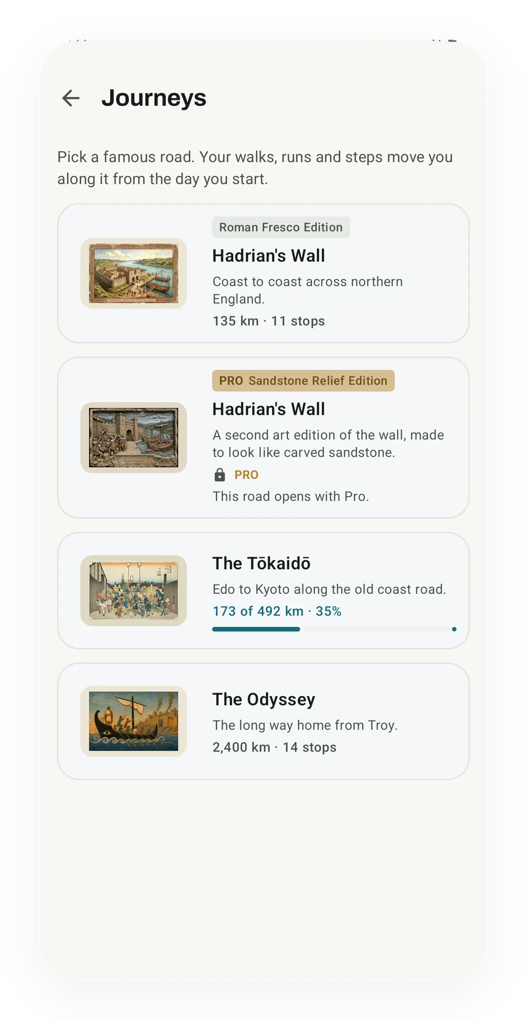
Pick somewhere to go
All three roads are free, with Hadrian's Wall in its Roman Fresco edition. Its Sandstone Relief edition is part of Pro.
 Open full-size image ↗
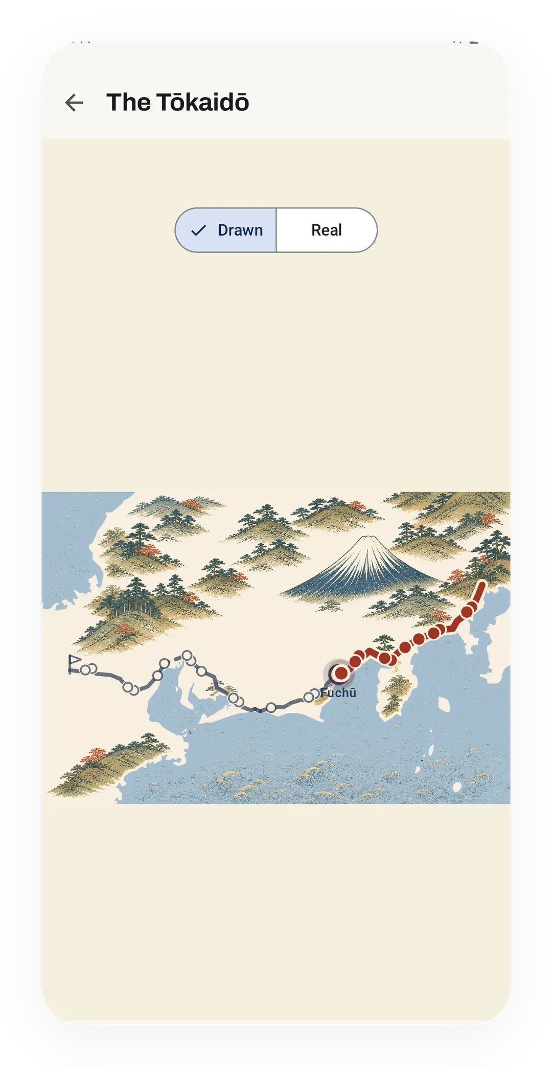
Your place on the map
The Tōkaidō's full map shows the walked part of the road in red, up to Fuchū. The Drawn style works offline, and Real puts the route on world map tiles that need a connection.
 Open full-size image ↗
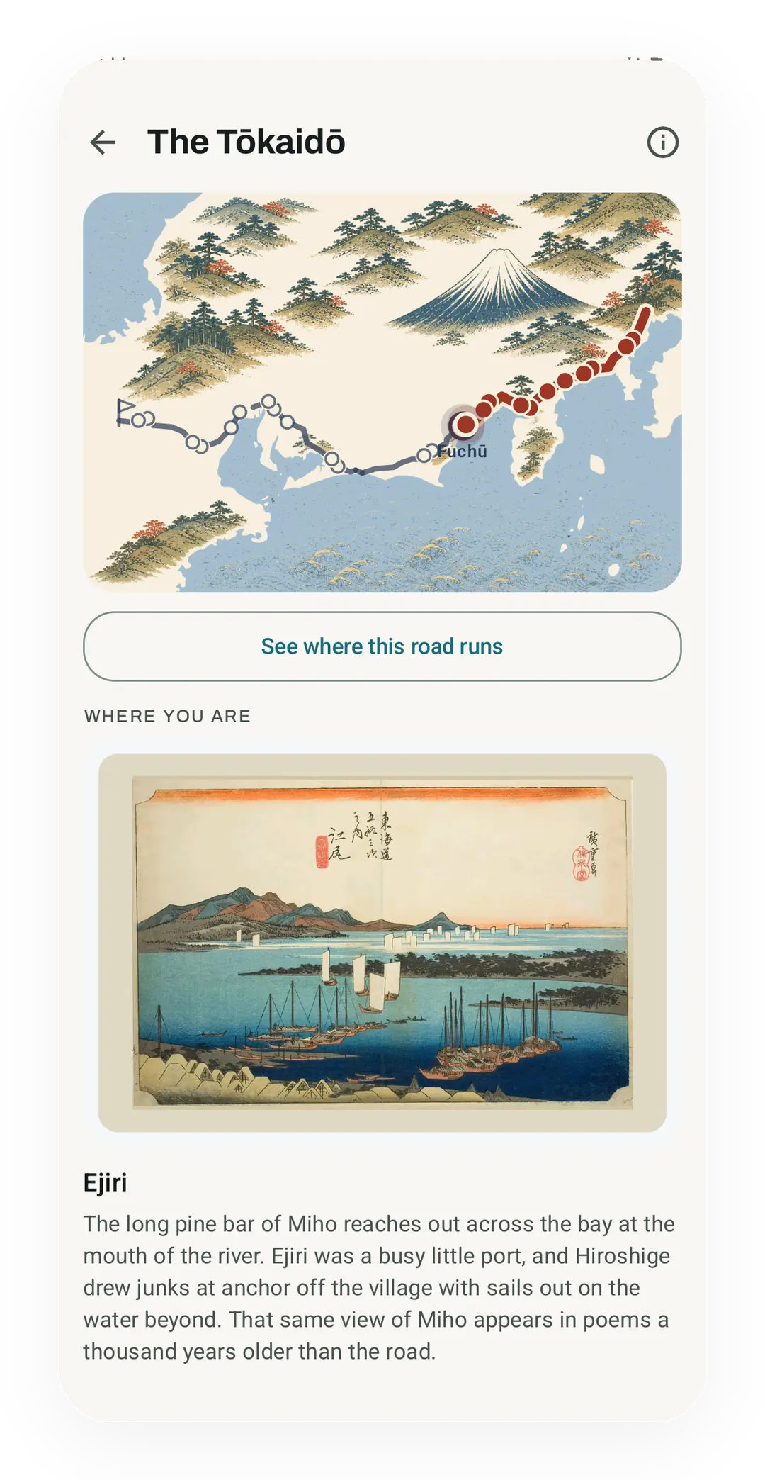
Walk through Hiroshige's prints
Under the map, the Tōkaidō shows the print for the stop you have reached, here Hiroshige's Ejiri with a short story about the port. Most of the road's pictures stay covered until you get to them.
 Open full-size image ↗
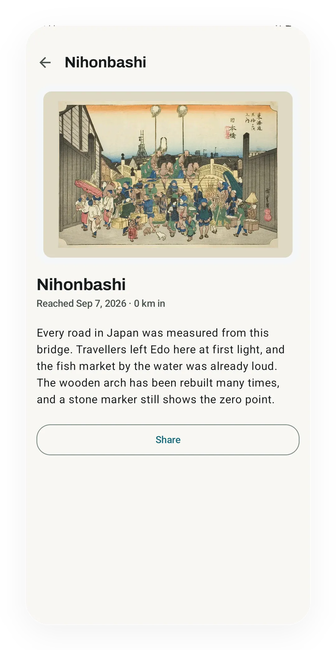
A picture with a place behind it
Each stop you reach keeps its print, date and distance, so Nihonbashi reads Sep 7, 2026 and 0 km in, above its story and a Share button.
Free roads and Pro editions
How access changes by tier
Hadrian's Wall, the Tōkaidō and the Odyssey include every stop, picture, story, map and postcard. There is no deadline.
A separately illustrated edition of Hadrian's Wall. Start it with Pro and you can finish that walk even if Pro ends.
Try it for yourself.
Available on Google Play. The core here is free. Pro adds optional extras.
Get on Google PlayRelated surfaces
Daily steps, streaks, brisk minutes, and an hour-by-hour view of how you moved.
Live pace, splits, a route map, and audio cues. Your run record is not uploaded to Kinoku; map tiles load when you view maps, and weather is a clear opt-in.
Seven free, offline-first paths to named bodyweight skills, with editable routines, evidence-based progress, graduation receipts, and no active-journey cap.
41 templates across many data sources, with deeper detail as your tier goes up.
Five Android widgets for the home screen: today's next move, one progress signal, quick actions, your score and goals as three rings, and the muscles you trained in the last 7 days. The core is free; Pro adds the deeper views and Quick Log.